Key Points
- High-Altitude Scientific Expedition: A joint research team conducted a ten-day fieldwork expedition in the Norwegian mountains to map high-altitude snow patches, assess volume changes, and collect environmental samples.
- Massive Spatial Coverage: Equipped with the portable Artec Jet 3D scanner, researchers successfully digitized approximately 128,000 square metres of complex, icy terrain across two main study zones.
- Rapid Data Capture: Using a specialized backpack mount system, the team mapped 51,500 square metres of snow patch surroundings above Oppdal in just two hours and scanned an 180-metre ice tunnel at Klimapark 2469 in 15 minutes.
- Multidisciplinary Research Scope: Executed under the OneZoo initiative, the project combined high-density 3D surface scanning, 3.4 kilometres of ground-penetrating radar (GPR) transects, and the retrieval of 120 kilograms of ice and biological samples.
- Institutional Collaboration: The field campaign brought together glaciologists Alice Phillips and Tris Irvine-Fynn from Aberystwyth University, laser scanning specialist Deri Jones from Deri Jones & Associates (DJA), partners from the Norwegian Institute for Nature Research (NINA), and equipment developer Artec 3D.
Norway (Norway Post Magazine) November 9, 2026 – A international scientific research team has completed a high-precision 3D mapping survey covering 128,000 square metres of high-altitude snow patches and glacial terrain across the Norwegian mountains to track environmental change and ice melt rates. As reported by Chronicle.lu and official technical case reports published by Artec 3D, the ten-day expedition combined mobile laser scanning technology, ground-penetrating radar transects, and biological sampling to analyze high-altitude cryospheric dynamics. Supported by Luxembourg-based hardware developer Artec 3D—which provided its lightweight Artec Jet LiDAR scanner, custom backpack mounting systems, and processing software licenses—the expedition demonstrated how modern mobile Simultaneous Localization and Mapping (SLAM) technology can drastically shorten fieldwork timelines in harsh mountain environments.
- How Did the Research Expedition Map 128,000 Square Metres of Norwegian Mountain Terrain?
- What Role Did the Artec Jet Scanner Play in Accelerating Mountain Fieldwork?
- How Was the Technology Used to Digitise the Klimapark 2469 Ice Tunnel?
- Which Institutions Participated in the OneZoo Initiative Expedition?
- Background of the Particular Development After the News
- How This Development Can Affect Glaciology Research, Environmental Policy, and Reality Capture Technology
How Did the Research Expedition Map 128,000 Square Metres of Norwegian Mountain Terrain?
According to technical accounts published by 3D scanning specialist Deri Jones of Deri Jones & Associates (DJA) for Artec 3D, the field campaign deployed a combination of mobile surface scanning and subsurface radar profiling across remote sites situated more than 1,500 metres above sea level.
Operating under unpredictable alpine weather conditions, the researchers examined three distinct snow patches during ten days of continuous field measurements.
Reaching the primary survey sites required strenuous ascents, including two-and-a-half-hour treks carrying sensitive analytical equipment over rocky, unstable ground.
The integrated survey methodology comprised three primary technical components:
- Mobile LiDAR Surface Scanning: The team digitised approximately 128,000 square metres of snow surfaces, rock forefields, and ice structures.
- Ground-Penetrating Radar (GPR) Transects: Scientists completed 3.4 kilometres of radar transects to record internal ice structures and establish precise subsurface thickness profiles.
- Physical Sampling: The team harvested roughly 120 kilograms of ice cores and biological samples for detailed laboratory analysis.
As reported by Deri Jones of DJA, the combination of laser surface surveys and radar depth profiles enables researchers to calculate overall snow patch volume accurately and compare the data directly against historical airborne Lidar records.
What Role Did the Artec Jet Scanner Play in Accelerating Mountain Fieldwork?
As reported by technical press outlets covering reality capture technology, the deployment of the SLAM-based Artec Jet scanner represented a major departure from traditional tripod-mounted terrestrial laser scanners.
In alpine glaciology, conventional tripod scanning requires researchers to repeatedly set up, level, and calibrate heavy equipment on slippery, steep slopes—a process that often takes hours and exposes field crews to changing weather risks.
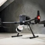
By mounting the 1.57-kilogram Artec Jet scanner onto a specialized ergonomic backpack system, researchers kept their hands free to operate walking poles and ice axes safely across steep terrain.
Detailing the performance of the backpack-mounted scanning setup during field operations above Oppdal, scanning lead Deri Jones explained how rapidly the equipment captured complex surface features.
As reported by Deri Jones of DJA in his technical field report, the team completed four traverses to cover the snow patch and surrounding forefield, mapping around 51,500 square metres in just two hours while avoiding the steepest hazard zones.
Jones noted that the resulting dataset was detailed enough to resolve micro-topographical features, including small drainage runnels in the ice surface and individual scattered rocks.
As reported by Deri Jones of DJA, the speed of data collection meant that “the limiting factor became battery life,” rather than physical fatigue or daylight constraints.
To ensure metrological precision across vast areas, the team deployed ground control points combined with satellite positioning systems to georeference all survey datasets into standard spatial coordinate systems.
How Was the Technology Used to Digitise the Klimapark 2469 Ice Tunnel?
According to case study documentation published by Artec 3D, the expedition also targeted the famous Klimapark 2469 site located on Galdhøpiggen, Norway’s highest mountain peak.
The site features a hand-carved ice tunnel that cuts deep through an ancient snow patch, serving as an educational center showcasing local glaciology, Scandinavian folklore, and archaeological artifacts recovered from melting ice.
Taking advantage of a brief break in tourist foot traffic, the research team conducted a rapid interior digitisation of the site’s interconnecting subterranean rooms and passageways.
The comparative operational efficiency was stark:
- Mobile SLAM Scan Time: The team mapped 180 metres of subterranean ice tunnel passageways in just 15 minutes.
- Conventional Tripod Scan Time: Deri Jones estimated that achieving equivalent spatial coverage using traditional tripod-mounted laser scanners would have required several hours of setup and repositioning.
The rapid scan captured detailed geometric profiles of the ice walls, structural support elements, and surrounding snowbanks without disrupting visitor access or exposing equipment to prolonged moisture.
Which Institutions Participated in the OneZoo Initiative Expedition?
As reported by Chronicle.lu and Artec 3D, the field campaign formed part of the broader OneZoo research initiative, an interdisciplinary project examining environmental shifts, microbial ecosystems, and cryospheric change.
The research contingent brought together expertise from academic, state, and private technical institutions:
- Aberystwyth University: Glaciologists Alice Phillips and Tris Irvine-Fynn led the scientific design, focusing on ice melt dynamics, volumetric change, and meltwater chemistry.
- Deri Jones & Associates (DJA): Managing Director Deri Jones directed spatial survey operations, 3D laser scanning logistics, and dataset integration.
- Norwegian Institute for Nature Research (NINA): Local research partners facilitated regional access, environmental permits, and biological sampling protocols.
- Artec 3D and Central Scanning: Hardware developers Artec 3D and its regional partner Central Scanning provided the Artec Jet hardware, backpack mounts, and processing software licenses (Artec Studio and Artec Twins) to evaluate mobile LiDAR capabilities under extreme environmental conditions.
Background of the Particular Development After the News
High-altitude snow patches in northern Europe—often referred to as perennial snowfield patches or ice patches—differ from active valley glaciers in that they do not flow under their own weight. Despite their static nature, these ice bodies play an outsized role in regional hydrology, alpine ecology, and Scandinavian archaeology. Over recent decades, warming temperatures across the Scandinavian mountain range have accelerated the retreat of these ancient ice patches, frequently exposing biological material and preserved organic artifacts—such as arrows, textiles, and hunting tools—that have remained frozen for centuries.
Historically, monitoring the volumetric shrinkage of remote snow patches presented significant logistical challenges. Glaciologists relied heavily on manual probe measurements, ground-penetrating radar, or periodic airborne Lidar surveys flown by aircraft. While airborne Lidar provides broad spatial coverage, its resolution can miss small-scale surface changes, and fixed-wing flights are expensive and subject to weather delays. Ground-based tripod scanners offered millimeter-level detail but were heavily constrained by weight, battery performance, and the physical hazards of positioning tripods on steep, unstable ice slopes. The emergence of lightweight, mobile SLAM-based LiDAR units between 2024 and 2026 transformed environmental reality capture, allowing field scientists to walk continuous transects across rugged terrain while capturing high-density 3D spatial points in real time.
How This Development Can Affect Glaciology Research, Environmental Policy, and Reality Capture Technology
The successful deployment of mobile 3D LiDAR scanning in Norway’s high-altitude snowfields will produce key operational and scientific impacts across environmental research and commercial surveying.
Impact on Glacial Scientists and Cryospheric Researchers
For glaciologists and climate scientists worldwide, the integration of high-speed mobile LiDAR into routine field surveys drastically lowers the time and labor cost of mapping remote ice masses. Research teams can now conduct frequent, high-resolution volume audits across entire seasons rather than relying on annual or multi-year estimates. This enhanced temporal resolution will improve numerical models predicting seasonal meltwater output, regional water availability, and mountain ecosystem shifts.
Impact on Alpine Archaeological Preservation and Cultural Heritage Management
For cultural heritage managers and alpine archaeologists, rapid mobile 3D mapping provides an invaluable tool for disaster-response documentation. As warming temperatures cause perennial snow patches to melt rapidly, organic artifacts exposed to oxygen deteriorate within weeks or months. Deploying mobile SLAM scanners allows heritage teams to digitise newly exposed archaeological sites and surrounding ice stratigraphy in minutes, preserving complete spatial digital twins before physical degradation occurs.
Impact on Geospatial Surveying and Hardware Development
For commercial surveying firms and reality capture hardware manufacturers, the expedition proves the ruggedness and reliability of mobile LiDAR systems under sub-zero, high-altitude conditions. Demonstrating that lightweight SLAM scanners can capture survey-grade spatial data in GPS-denied environments—such as deep mountain ice tunnels—will accelerate adoption across mining, subterranean infrastructure inspection, forestry, and disaster-management industries worldwide.